
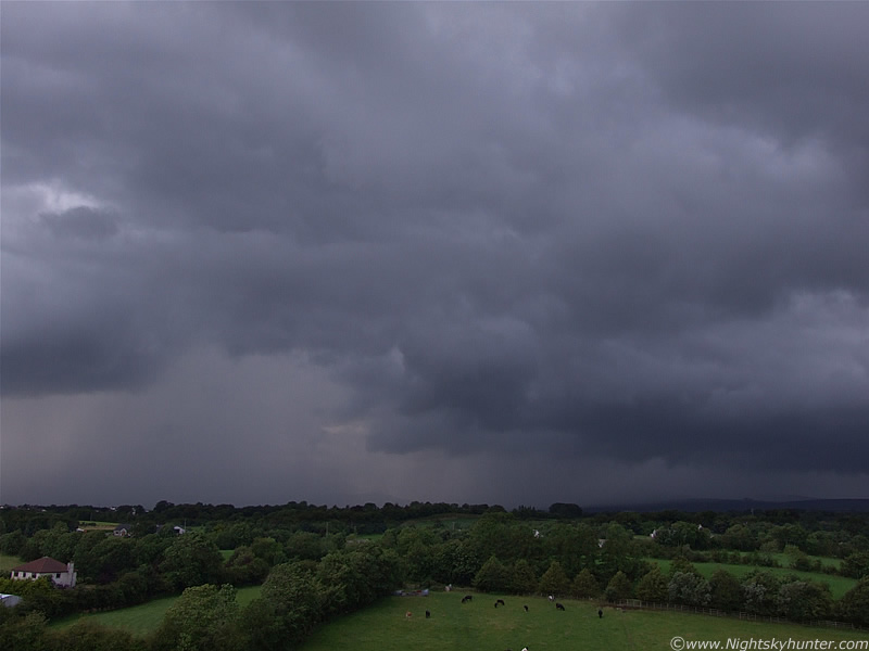
Tuesday July 21st 2009. A convective forecast had been issued for parts of Ireland, N. Ireland, and UK for thunderstorms during the late afternoon. A low pressure system was moving NE near Ireland so during the morning and afternoon heavy rainfall was expected due to the passage of an occluded frontal system which would sweep up across the country. Behind it, in the unstable air mass, heavy showers and thunderstorms where expected to break out thanks to a decent amount of instability and solar insolation. The Met Office had issued a severe weather warning for all over N. Ireland for thunderstorms and heavy rainfall with a risk of flooding. This was later followed by a convective discussion from TORRO for c-g lightning, heavy rain, hail, and a risk of isolated tornadoes. I was not very excited by this set-up, and although I knew storms could form, I wasn't expecting anything big to happen so I spent my day working on other things. By the late afternoon I thought the chances of storms would have been zero because the frontal system and taken alot longer to clear, and as we approached the prime heating time of the day, it was still cloudy/overcast and the Sun hadn't even broke out yet to work on the ground and generate convection, so I thought it would be a bust day here.
Later still, I look outside and see blue sky in places as the front pushed away further N and the Sun began to show itself but I honestly thought it was too little too late. However, not wanting to give up and always the optimist I decided to check out what was happening online so I could built a mental picture and time line of the current convective reports and asses if there was a chance of action this far N. I figured that with the front, having already cleared earlier in the day over the Republic of Ireland, that there could well be storms developing in the heat, and if that was the case then the Sly flow could bring them up this way. I check the radar and bingo!, just as I thought, there where storms in central and W sectors of Ireland which where moving N and where already in the process of crossing over the border into NI. The flow was pretty slow moving so I thought they would take a long time to reach here so I began to loose faith again, they would probably die out by the time they reached here, however the sferics charts looked extremely active with many strikes suggesting intense storms with long life cycles were the order of the day so I began to get a good feeling.
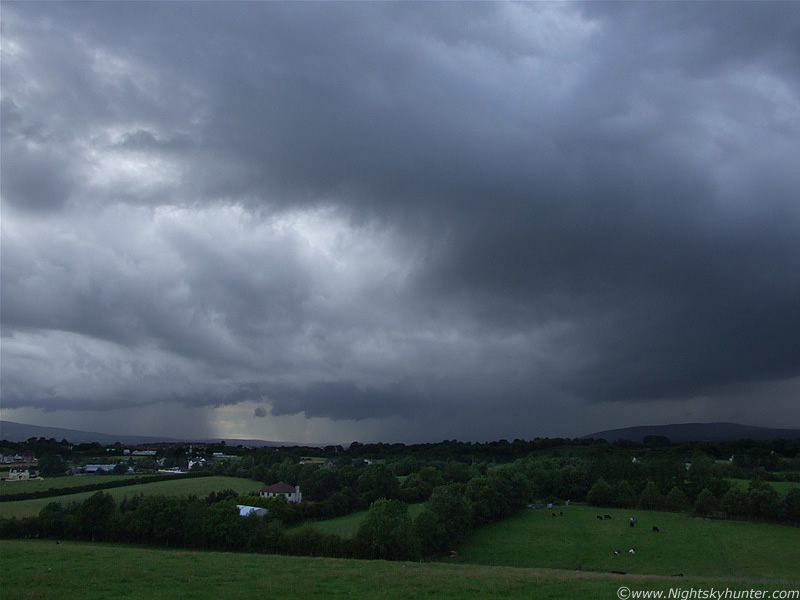
Meanwhile, during the early evening around 18.00 BST I could smell my dinner cooking downstairs and was looking forward to it, I was staving and needed something to generate some energy or I would fall asleep. I look out the window to the E, no convection worth looking at, darn!, so log back on the net and check the radar and sferics one last time. My goodness, those storms where already close to hitting my location in Maghera, judging by the radar they should be visible already to my SW over the Sperrin Mountains with more to the S behind Slieve Gallion. I go downstairs, open the front door, and step outside into the hot sunshine for a visual check on the sky...yikes!. I had an instant visual on the storms. Huge billowing convective towers could be seen leaning upward and outward from a black mass over the trees to my SW with large chunky anvils to the SW in a long chain of impressive clouds. Just as I was thinking ''why am I not hearing thunder at this range?''...a loud angry rumble of thunder booms across the land from the SW like a huge ill-tempered animal. Then another...I curse myself for leaving it too late, the storms where already in the Maghera area and I had missed my chance of anticipating their movement and getting out in advance to see them approach. Dinner was ready...it went back in the oven, I grabbed by camera gear and left the house with a complaining stomach. I had a feeling this wasn't going to be a few rumbles and back to sunshine, this was only the beginning.
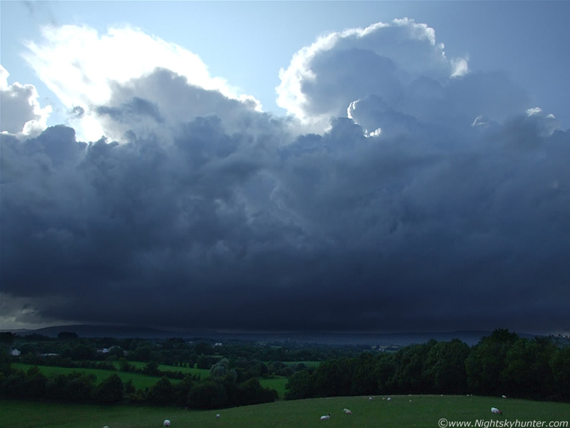
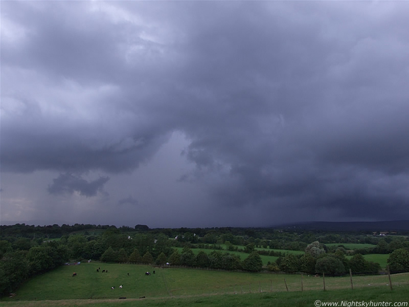
I relocate outside Maghera a little bit to the S to my usual high vantage point for watching local storms and check out the scene. Before I go any further I should mention that I later found out that the 18z GFS run had completely upgraded the set-up to 1000 CAPE and LI of -3, with even -4 a short distance away to my W which made perfect sense. The midday run had only 600 CAPE and LI of -1 so that was a very significant jump in instability. The view over the mountains was impressive with a huge cluster of very large cells to my W over the Sperrins.
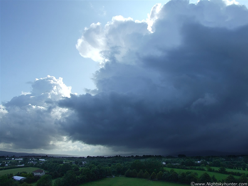 |
Image spans SW to W with cells moving L to R. This beast was the thundering animal I heard from home. It was a multicell with a selection of very tall updraughts and several anvils with solid looking bumps or 'knuckles' along the rim of the anvil canopy. The storm was miles away however I was still having trouble getting it into the 28mm lens field.
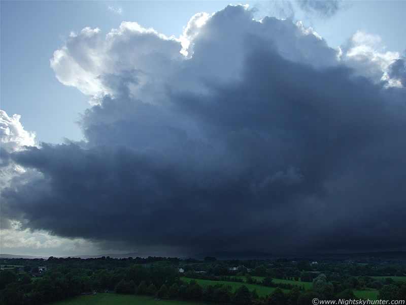 |
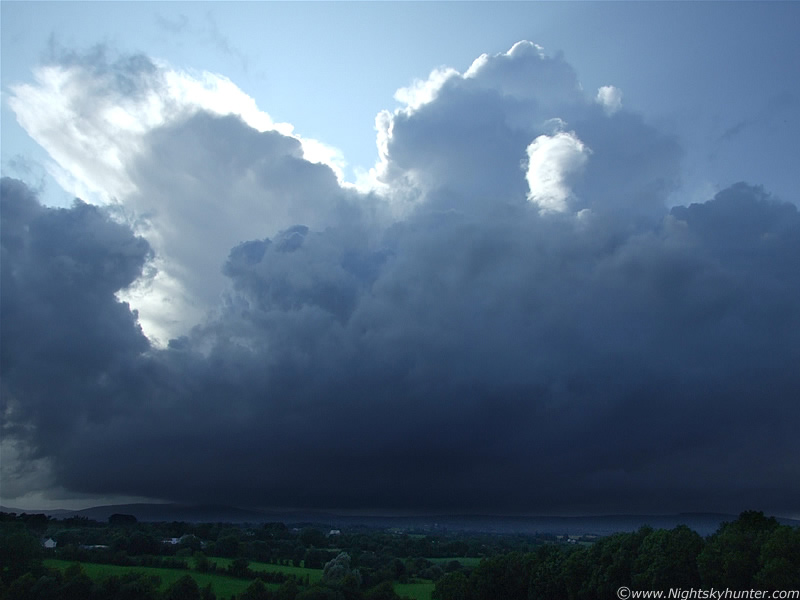
Images never convey a sense of size with these things, I was actually cranking my neck and looking up to see the updraught towers and anvils which blazed bright white in the evening Sun while the main body of the storm had a brutal looking black-blue colour due to being partially back-lit.
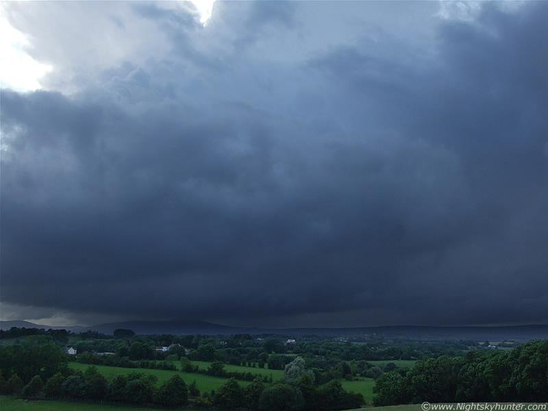 |
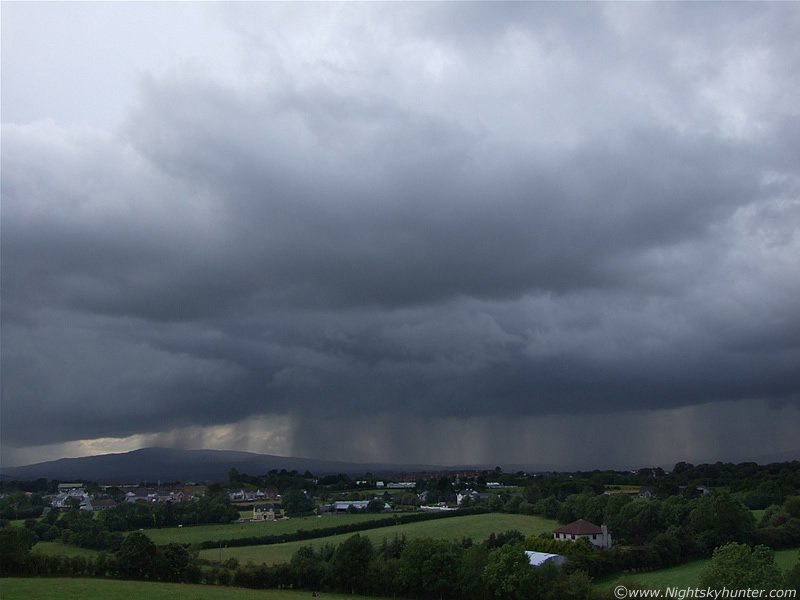
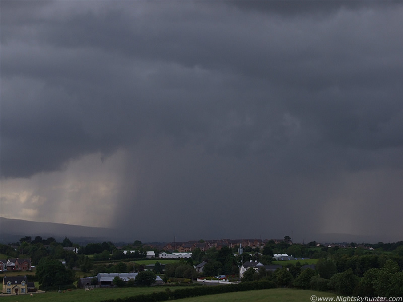
The trees and houses in some way help to give a rough sense of scale. Looking due W here over the W side of the undulating Sperrins. The base of this storm was almost at ground level, in fact, for a long time I watched as inflow and outflow cloud actually touched the mountains themselves and dragged across it in dramatic fashion. There was rich levels of moisture at low levels so that cloud was condensing out of everything. At times, under the dark cb bellies, it was difficult to tell where the ground ended and clouds began. Heavy precip was falling over the high ground and down the E side of the hills on the other side.
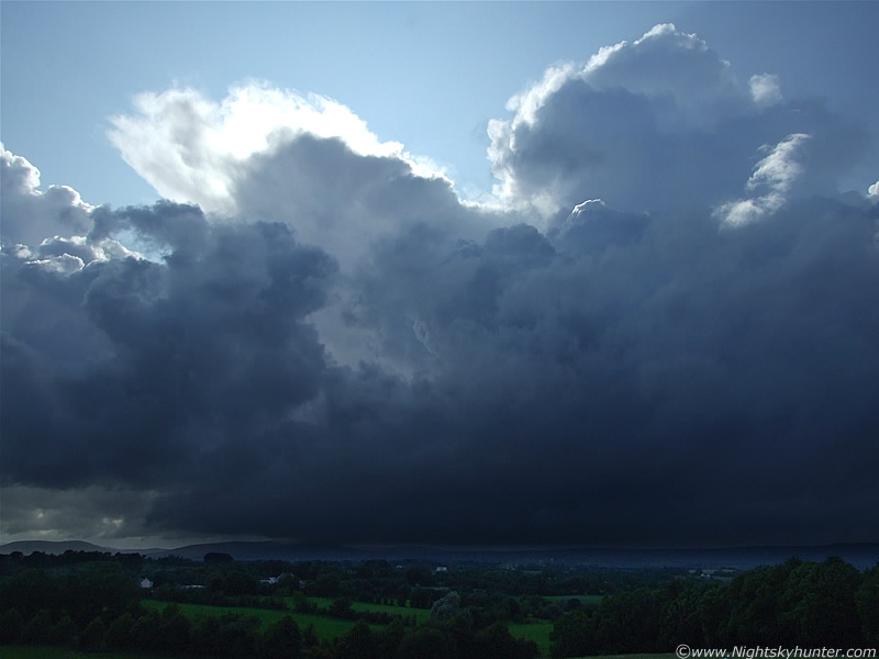 |
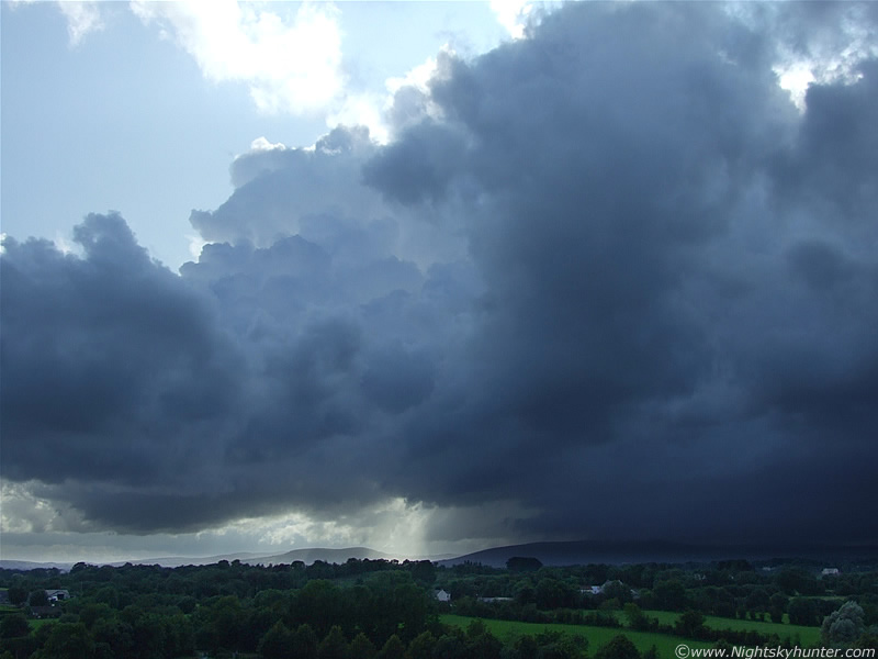
It was a dynamically changing cell with new updraughts going up and new anvils forming while the old ones relaxed, feeling content with their new height, then collapsed again to be replaced by yet another.
 |
There's not much space between the storm and mountains here!. If you where standing on the mountain the storm base would probably take the hat off your head lol. The outflow rain-cooled air rapidly condensed and formed this eerie bank of mist along the mountain valleys.
 |
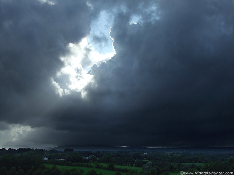
You can just make out vertical lines of mammatus on the overexposed anvil to the upper L. Check out the lonely patch of cloud catching the Sun between me and the updraught tower R of centre. This is the same area where I saw a Sheep getting hit and killed by lightning in June.
 |
To the L at the flanking area of the storm new updraught towers began to build with eye-catching speed. You can see one of them to the LOC on this image, which was huge in reality. I always like to watch the rear cb or tower on a line of storms/convective frontal system. These last ones differ from the others within the main body of the storm due to the fact that there's less competition from the other cells so it can feed from the surrounding environment in a more serious way and flourish in the freshly exposed ground heat. This last cell/updraught/storm is often called a 'Tail End Charlie' and has the greatest potential for producing severe weather. Tail End Charlies associated with severe cold fronts are the biggest producers of strong tornadoes in the UK, especially during the Autumn and Winter thanks to Atlantic low pressure systems and gales creating strong wind shear for tornadogenisis. While the above example is only an updraught tower, I always feel they merit close watching because of the potential to drop a funnel cloud or develop into another storm if the atmosphere is favorable. That updraght had a great well defined base on it which was very evident even from this distance. It doesn't show up well on the image but at the time I could see great rounded structure and lines from which little sprouts of scud could be seen. It looked the part, however no funnels dropped. Sun beams are visible through the rear of the cb.
 |
Same scene a little later, however look how different and tall that updraught is compared with the last image. It has the classic crisp appearance indicating a strong updraught. That black tower goes all the way down and touches the mountain itself. It would continue going up and churn out new anvils and would soon become a very electrically active storm. Tail End Charlie was at it again. Crepuscular rays are visible piercing through the back of the tower.
 |
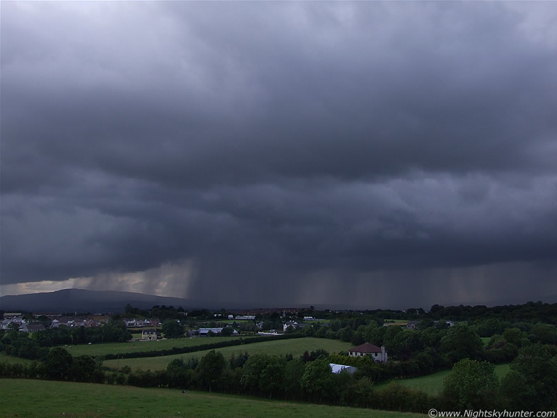
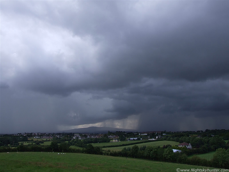
A new line of multicells arrived in from the S (L) with massive anvils/towers and began to slowly creep across the Sperrins while intensifying by the min. Out of frame to the L was another monster multicell with a gorgeous white anvil with bubbling mammatus on the N side of the thunderhead which stretched across the sky from S to SE. Heavy precipitation curtains where falling from it and behind was a gorgeous rain free base which was low to the ground and just begging for a attention. C-gs fired out from that core and the cell began its approach towards me. Back to the R, and to the subject in the above image, these are two storm lines stacked like buses, one behind the other. The lead cell, of which you can see the rear of to the R, was very dark, and below it awesome pink-coloured in-cloud (i-c) lightning lit up the dark sky over the mountains and briefly turned the precip curtains pink. The thunder which followed was impressive.
 |
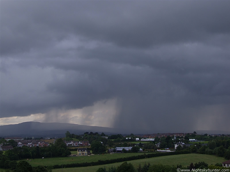
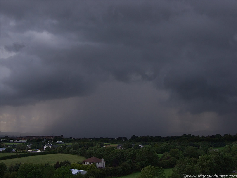
Now concentrating on the area to the SW of Slieve Gallion. The cells really were going for it here with multiple cores of heavy precip breaking out in fantastic looking lines. Pink c-gs hit down from this entire area from two sections. The area between centre and LOC, then the area to the R, both dropped lovely c-gs which I could clearly see hitting the ground. This was fantastic, I was now watching 3, possibly 4 electrically active multicell storms at the same time. It was thrilling to watch the lightning hit one place, then another would catch the edge of my vision in a different sector, then another in front of me. I didn't know where to be looking. On occasion the lightning from several different cells lit up at the same time. The cells from the W-NW and SW seemed to do this alot, however the W cells where closer so the thunder came at different times despite the synchronized flashes. There's something very special and unsettling about the sound of thunder in the hills and mountains, it has a strange growling sound of its own which I can't put my finger on. So, I would get two flashes at the same time followed soon after by another from the cell in the S, and I would get three different rumbles at different times according to their distance from me.
 |
Structure-wise, the coolest thing about these storms was the amazing precip lines/cores which seemed to switch on as if a tap had been turned. The precip breaking out under the storm line to the SW was incredible. While lightning flashed and thunder boomed I tried to get images of the cores despite the wind picking up and spots of rain getting blown on me now from the outflow of the cell in the S which was getting closer.
 |
Look how dark, intense, and highly concentrated this precip core is. I really do love the structure in precip cores from storms, the more dense the better, you can usually tell if a storm will be nasty or not judging by the strength of the rain and how concentrated it is. The most electrically active storms I have seen this year had notable precip curtains held tightly together in a controlled and organized fashion by the storm.
 |
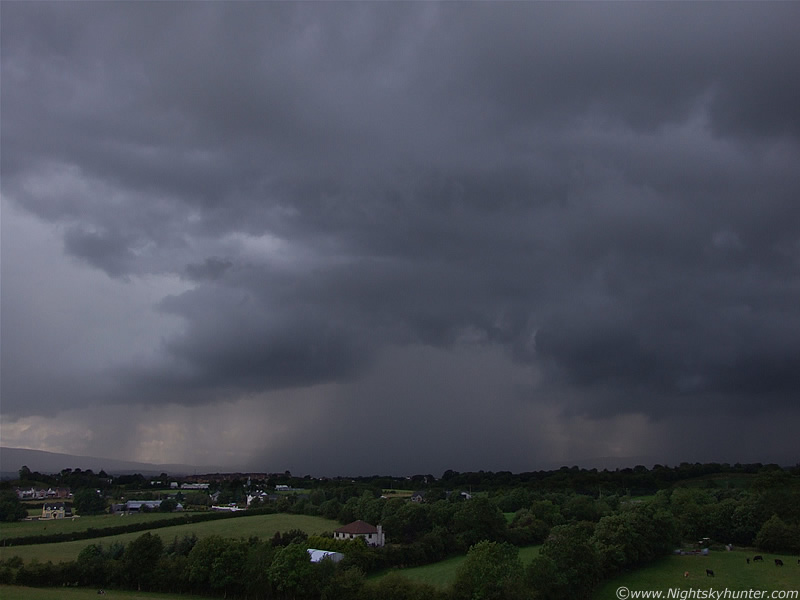
This looked quite crazy at the time as the intense core of torrential rain drifted slowly over the countryside from L to R. That looks to be in the direction of Sunny Side. What made this even more of a treat was the fantastic lightning. Very well defined rapid c-gs hit down within that rain and looked like they meant business striking down hard with purpose. More pink bolts hit to the R of the core and even a few where seen to the L along the flank of the mountain. I took many images at this stage hoping I could catch one of those bolts on camera, that would have made such a dramatic image.
 |
Wide shot spanning S to SW. To the L is the approaching cell I mentioned earlier which had the huge anvil. C-gs hit down within that bright precip as it approached me. The camera was getting rain drops on the lens so I had to periodically wipe it dry. To the R, c-gs continued hitting down, and out of frame to the R, in the W to NW, was a very active storm. With the base so dark and low to the ground the rain and land seemed to light up with huge pink flashes of i-c bolts which flickered across a large angular extent of the sky similar to an anvil crawler. It was spectacular and nasty looking. These flashes were frequent too. So, when this image was taken there where three active storms at the same time all flashing and booming, and I was having a great time watching them all, and what a view I had from this high location where everything could be seen for miles. It was starting to get wet and gusty now and with the precip of the S cell approaching I would soon have to pack the camera away.
 |
This was interesting, note the shape of the precip curtain along the ground. The L side of it is blown back in that direction. This is called a 'Rain Foot' and is the first time I have knowingly seen one. It's caused by the effects of wind shear when powerful straight line winds at ground level alter the shape of the falling rain, the wind is stronger at ground level than it is higher up. Just to be certain I asked storm chaser Mike Hollingshead for his advice and he agreed that it was indeed a rain foot. Thanks for your help Mike!. You can see a good example of a Rain Foot on Mike's site here, it's the 44th image down.
 |
Wider shot of the rain foot, still the c-gs were doing their thing and I was panicing trying to catch one of them in the act. I have never caught a daylight bolt on a still image before so I was trying my best to change that. However, with the semi-fast shutter speeds I was using it was unlikely to happen today, especially when lightning was luring me from three different directions and I was spinning the camera around to try those then back to here again.
 |
Tracking the storm has it moves past me from L to R. Now facing W to NW. Earlier those Cows where on high ground, however a very cloud clap of thunder sent them all running down the field to that corner on low ground. It's funny how they know to do that.
 |
The side-one storm doing it's thing. Look at the dense precip falling over the hills here, the huge pink strobes of lightning lit that area up from blue-purple to pink. I bet the area further W got a major hammering from those storms, that was the region where the LI was -4. In that direction it is mostly desolate countryside then it stretches over to the Glen Shane Pass, and beyond that, Dungiven. Later I checked the sferics charts and the entire central and W side of NI was covered in a blanket of dense red indicating an incredible amount of lightning from these storms. Soon after the above image was taken rain arrived over me so I packed the camera away and watched the storm. The strap on my camera carrying case suddenly broke and the camera itself fell out and hit the ground, luckily it landed on thick grass so it survived the encounter intact. Taking shelter I relaxed and watched the rear precip core on the last storm in the line for a long time until it had moved into the N. Flashes continued for a long time until I could no longer see them, however the thunder periodically rumbled away for some time after that. It was 19.30 when the storm was no longer audible, I had been hearing thunder for 1.5 hours. Quite an impressive evening, that's five multicell storms which passed within close range and each one of them put on a good show. This was definitely one of those good Summer thunderstorms which I won't forget. This brings the 2009 season's count to 22-23 thunderstorms!. Thanks for reading.
Martin McKenna